What are the physical features of Pakistan?
Pakistan is a country blessed by Allah Almighty with adequate resources. In terms of natural resources and physical features, Pakistan has the best geographic location.
The map of Pakistan showcases the country’s diverse physical features, ranging from the northern mountains to the fertile plains and vast deserts. Understanding the physical features of Pakistan is crucial in comprehending the country’s climate, agriculture, economy, and biodiversity. This guide explores the mountain ranges, river systems, plateaus, deserts, and other distinctive landforms of Pakistan. Features of Pakistan are an important topic in the Edexcel and Cambridge boards.
According to Pakistan studies past papers, the features of Pakistan are an intriguing topic that often appears in the 6-mark geography questions. Thus, this topic should be well prepared for appearing in the examination.
Location of Pakistan and Its Geographical Extent
Situated in South Asia, Pakistan shares borders with India to the east, China to the north, and Afghanistan and Iran to the west and has a southern coastline along the Arabian Sea. The country lies between 24° and 37° North latitude and 60° to 77° East longitude, covering a total area of 881,913 square kilometres. The location of Pakistan makes it strategically significant as a trade corridor between South Asia, Central Asia, and the Middle East.
This significant location is gifted with the beautiful physical features of Pakistan. They are a source of the running economy and building tourism.
Major Physical Features of Pakistan
Pakistan’s diverse topography includes mountain ranges, fertile plains, plateaus, deserts, and coastal areas. These natural features shape the country’s climate, culture, and economy.
1. The Northern Mountains
The northern mountains of Pakistan are part of some of the world’s most famous and impressive mountain ranges: the Himalayas, Karakoram, and Hindu Kush. These ranges are not only geographically significant but also play a pivotal role in Pakistan’s climate, economy, and culture.

- K2 (8,611m)
Known as the “Savage Mountain” due to its challenging terrain, K2 is the second-highest peak in the world. It lies in the Karakoram Range, near the Pakistan-China border. It has earned a reputation for being one of the most difficult mountains to summit, attracting skilled climbers and adventurers worldwide. The mountain’s sheer rock faces, unpredictable weather, and extreme altitude make it a prized but deadly challenge for mountaineers. - Nanga Parbat (8,126m)
Often referred to as the “Killer Mountain”, Nanga Parbat is one of the deadliest peaks in the world, located in the Himalayas. Despite its perilous nature, it is still a popular destination for experienced climbers. Nanga Parbat’s immense snow-covered slopes and towering summit offer stunning views of the surrounding valleys. - Broad Peak (8,051m) and Gasherbrum I & II (8,080m & 8,035m)
These peaks, part of the Karakoram Range, are collectively known as the “Karakoram Giants” and are located near the famous Baltoro Glacier in Gilgit-Baltistan.
2. The Fertile Plains of Pakistan
Stretching across Punjab and Sindh, the fertile plains of Pakistan are primarily shaped by the Indus River and its tributaries (Jhelum, Chenab, Ravi, and Sutlej). These plains are the backbone of Pakistan’s agriculture, producing wheat, rice, sugarcane, and cotton, which are essential to the country’s economy.
- Punjab Plains: Known as the ‘breadbasket of Pakistan’, these plains are highly fertile and heavily cultivated. The presence of extensive irrigation networks allows for the production of staple crops, supporting Pakistan’s food security. These plains also host major cities like Lahore, Faisalabad, and Multan, which are crucial economic hubs.
- Sindh Plains: Dominated by the Indus Delta, this region is known for its extensive irrigation system, which supports agriculture despite the semi-arid climate. The fertile lands here are particularly suitable for growing rice, wheat, and sugarcane. The deltaic region also sustains rich biodiversity, including mangroves and aquatic species.
- Indus Basin Irrigation System: One of the largest irrigation systems in the world, covering millions of hectares of farmland. It consists of a complex network of dams, barrages, and canals that distribute water efficiently across the plains. Key projects include:
- Tarbela and Mangla Dams for water storage and hydroelectric power.
- Link canals such as the Rasul-Qadirabad Link Canal, ensuring water reaches various agricultural regions.
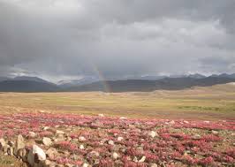
3. The Deserts of Pakistan
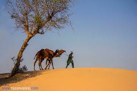
Pakistan is home to vast deserts with unique ecosystems and extreme climates. These deserts play a vital role in the country’s geography, hosting nomadic communities and supporting limited but significant economic activities. The two major deserts in Pakistan are:
The Thar Desert:
The Thar Desert spans eastern Sindh and southeastern Punjab in Pakistan, extending into India’s Rajasthan region. It experiences an arid climate with extremely high summer temperatures often exceeding 50°C and low annual rainfall ranging between 100 to 500 mm. Winters can be chilly with occasional frost. Despite these harsh conditions, the desert supports drought-resistant vegetation like acacia, cacti, and shrubs, and is home to wildlife such as blackbucks, chinkaras, peacocks, and desert foxes.
The Cholistan Desert:
The Cholistan Desert, located in southern Punjab near Bahawalpur, stretches into the Thar Desert and spans an area of approximately 26,300 square kilometers. It experiences hot summers with temperatures soaring above 45°C and cold winters, with nighttime temperatures often dropping close to freezing. Rainfall in the region is minimal and unpredictable, making water conservation essential for survival.
4. The Rivers of Pakistan
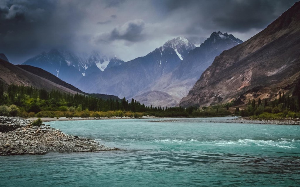
The Indus River System is the lifeline of Pakistan’s agriculture and economy. The river system plays a crucial role in irrigation, hydroelectric power generation, and the maintenance of biodiversity. The river originates in Tibet, flows through Ladakh and Kashmir, and enters Pakistan at Gilgit-Baltistan before traversing the entire country. It stretches approximately 3,180 kilometers, making it one of the longest rivers in the world.
Major Tributaries of the Indus River
The Indus River is supported by several major tributaries, which enhance its water volume and utility.
- Jhelum River: The river originates from Indian-administered Kashmir. It flows through Punjab, where it merges with the Chenab River. The river is of great importance as it houses the Mangla Dam, a major reservoir that supports both agriculture and electricity production.
- Chenab River: The river holds historical significance as it is often associated with Punjabi folklore and poetry, such as the tale of Heer Ranjha. It plays a crucial role in irrigation, forming a major part of the Indus Basin Irrigation System. Notable structures along the river include the Marala Barrage and Qadirabad Barrage.
- Ravi & Sutlej Rivers: The Ravi River flows through Punjab before merging with the Chenab River. The Sutlej River, one of the longest tributaries, is extensively diverted for irrigation purposes. Both rivers play a vital role in supporting Pakistan’s agricultural sector by contributing significantly to food production and water distribution.
5. The Climate of Pakistan
Pakistan experiences a diverse climate due to its varied topography:
- Highland Climate (Cold Climate in the Northern Mountains)
The highland climate, found in regions like Gilgit-Baltistan, Khyber Pakhtunkhwa, and northern Balochistan, is marked by long, harsh winters with heavy snowfall and short, cool summers. In high-altitude areas such as Skardu and Murree, winter temperatures often drop well below freezing. This region’s glaciers play a vital role as a water source for Pakistan’s river system.
- Arid & Semi-Arid Climate (Balochistan and Deserts)
The arid climate dominates Balochistan, the Thar Desert, and the Cholistan Desert, with extremely hot summers where temperatures can exceed 50°C. Low annual rainfall contributes to severe water scarcity, but the region still supports hardy vegetation and desert-adapted wildlife.
- Humid Climate (Monsoon Impact on Punjab & Sindh)
The monsoon climate affects Punjab and Sindh, especially from June to September, bringing heavy rainfall, high humidity, and seasonal flooding. While it supports agriculture and helps replenish water reservoirs and groundwater levels, it also poses challenges, such as urban flooding in cities like Karachi and Lahore.
Learn the geographical features of Pakistan with VACE Global:
The physical features of Pakistan make it a geographically rich and diverse country. From the northern mountains to the fertile plains, each landform makes a unique contribution to Pakistan’s environment, economy, and culture. Understanding these physical features is key to appreciating the country’s natural beauty and resources. VACE Global helps students get these concepts very easily with the help of expert faculty. Enroll today and start your academic journey with us.
FAQs:
1. What are the major mountain ranges in Pakistan?
The major mountain ranges in Pakistan include the Himalayas, Karakoram, and Hindu Kush, home to some of the world’s highest peaks, like K2 and Nanga Parbat.
2. How do the northern mountains of Pakistan impact the climate?
The northern mountains play a key role in regulating Pakistan’s climate by influencing air masses and precipitation patterns and creating natural barriers between regions.
3. What is the significance of the Indus River to Pakistan?
The Indus River is crucial to Pakistan’s agriculture, providing water for irrigation and hydroelectric power generation and serving as a vital drinking water source.
4. What are the main deserts in Pakistan?
Pakistan is home to the Thar Desert, located in Sindh and Punjab, and the Cholistan Desert in southern Punjab, both of which have unique ecosystems and extreme climates.
5. What role do the fertile plains of Pakistan play in its economy?
The fertile plains of Punjab and Sindh, shaped by the Indus River, are vital to Pakistan’s agriculture, producing essential crops like wheat, rice, and cotton.